Djibouti is a small country in the Horn of Africa, bounded by Eritrea to the north, Ethiopia to the west and south, and Somalia to the southeast. To the east it meets the Red Sea and the Gulf of Aden. Most of the country is semi-arid or arid, with sparse rainfall. Lake Assal, a saline lake about 155 m (509 ft) below sea level, is the lowest point on land in Africa and one of the lowest dry-land points on Earth. Only a few other depressions, notably the Dead Sea shoreline and China’s Turfan Depression, reach comparable or greater depths below sea level.
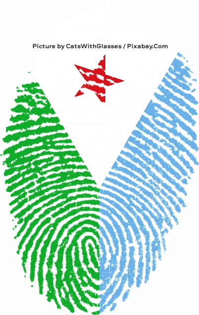
The photograph above shows a creative fingerprint design that recreates the national flag of Djibouti, with the left half of the print rendered in green ridges and the right half in light blue ridges that together form a downward-pointing V shape against a plain white background, while a red five-pointed star sits in the white triangular space at the top. Photograph by CatsWithGlasses / Pixabay.Com.
The country covers 23,200 km² (9,000 sq mi), of which 23,180 km² (8,950 sq mi) is land and 20 km² (7.7 sq mi) is water. It is among the smaller African states by area and ranks near 150th worldwide, depending on which territories are counted. Published figures for its land borders differ. One widely used set gives a total of about 575 km (357 mi): 125 km (78 mi) with Eritrea, 390 km (242 mi) with Ethiopia, and 60 km (37 mi) with Somalia. The CIA World Factbook instead lists 528 km (328 mi): Eritrea 125 km (78 mi), Ethiopia 342 km (213 mi), and Somalia 61 km (38 mi). A coastline of about 314 km (195 mi) faces one of the world’s busiest shipping routes, at the Bab el Mandeb strait linking the Red Sea to the Gulf of Aden and the Suez Canal. Djibouti’s ports serve as a commercial gateway between the Arabian Peninsula and the interior of the Horn, and the country is the coastal terminus of rail traffic into Ethiopia.
Major settlements include the capital, Djibouti City, the port towns of Tadjoura and Obock, and the southern towns of Ali Sabieh and Dikhil. The 2024 census recorded a population of 1,066,809, or about 1.07 million, making Djibouti one of Africa’s least populous countries. Most people live in and around the capital. Population growth has been boosted in recent years by refugees from neighboring states.
Landscape
Djibouti can be divided into three broad physiographic zones: the northern mountains, the Grand Bara, and the southern mountains. A great arc of highlands—including the Mousa Ali, Goda, and Arrei ranges—frames much of the country. Eight ranges rise above 1,000 m (3,300 ft).
- Mousa Ali, on the border with Ethiopia and Eritrea, is the highest point in Djibouti. Published elevations are usually 2,021 m (6,631 ft) or 2,028 m (6,654 ft).
- The Goda Mountains, northwest of the Gulf of Tadjoura in Tadjourah Region, reach about 1,780 m (5,840 ft) and contain the country’s largest area of relatively dense vegetation, including the Day Forest.
- Garbi, in western Tadjourah Region, rises to about 1,680 m (5,512 ft).
- The Mabla Mountains in Obock Region stand behind the coastal plain where the Red Sea meets the Gulf of Aden, on the northern side of the Gulf of Tadjoura. Cited high points range from about 1,375 m (4,511 ft) to about 1,780 m (5,840 ft).
- The Arrei Mountains in southern Ali Sabieh Region reach about 1,301 m (4,268 ft) near the Ethiopian border.
- Dagouein rises to about 1,124 m (3,688 ft).
- Hemed, in western Arta Region, reaches about 1,103 m (3,619 ft).
- The Boura Mountains top out at about 1,003 m (3,291 ft) in a semi-desert setting, where altitude produces sharp local differences in rainfall and vegetation.
The Grand Bara desert covers parts of southern Djibouti in Arta, Ali Sabieh, and Dikhil regions. Most of it lies below about 520 m (1,700 ft). It is also known for the Grand Bara footrace.
Most of the country belongs to the Ethiopian xeric grasslands and shrublands ecoregion. A coastal strip along the Red Sea forms part of the Eritrean coastal desert. That same northern shore is one of the world’s major bottlenecks for soaring birds. The Rift Valley / Red Sea flyway carries several million migrants between Eurasian breeding grounds and African wintering areas each year. At the Bab el Mandeb, the Red Sea narrows to its shortest crossing south of Suez. Large raptors and other soaring birds avoid long open-water flights, so they funnel across the strait between Yemen and Djibouti. Estimates put the annual passage at about 1.5 million soaring birds of at least 37 species, including several globally threatened ones. The Djibouti side of the strait is an Important Bird Area.
Autumn is the heaviest season. In October–November 1987, counters recorded more than 246,000 raptors of 28 species along the northern coast in 38 days, among the largest single-season totals in Africa. Steppe Buzzard (Buteo buteo vulpinus) and Steppe Eagle (Aquila nipalensis) dominated those counts—about 98,000 and 77,000 birds respectively. Pallid Harrier (Circus macrourus), Greater Spotted Eagle (Clanga clanga), Eastern Imperial Eagle (Aquila heliaca), and other scarce species also pass. Birds typically leave the Yemeni side near Perim Island. With northerly winds they make landfall at Ras Siyan; with southerly winds they are displaced toward Doumeira. They cross the coast relatively low, then climb over the hill at Ras Siyan (about 138 m / 453 ft) or the ridge at Doumeira (about 50 m / 164 ft) before continuing southwest into the Horn and the Rift. Peak movement is usually late morning. Spring passage is smaller and differently composed: surveys at Ras Siyan have found Egyptian Vulture (Neophron percnopterus) and Booted Eagle (Hieraaetus pennatus) among the most numerous returning birds. Black Stork (Ciconia nigra), Common Crane (Grus grus), and many passerines use the same corridor in smaller numbers. Inland the stream spreads out; the tightest concentrations remain at the strait. Despite its importance, the Djibouti crossing is still among the least regularly monitored major flyways.
Regions
Djibouti is divided into six regions. The conventional rounded areas are:
| Rank | Region | Area |
|---|---|---|
| 1 | Dikhil | 7,200 km² (2,780 sq mi) |
| 2 | Tadjourah | 7,100 km² (2,740 sq mi) |
| 3 | Obock | 4,700 km² (1,810 sq mi) |
| 4 | Ali Sabieh | 2,200 km² (850 sq mi) |
| 5 | Arta | 1,800 km² (690 sq mi) |
| 6 | Djibouti | 200 km² (77 sq mi) |
Some census and mapping totals differ slightly and sum to less than the national figure of 23,200 km² (9,000 sq mi). The ranking by size is stable: Dikhil and Tadjourah dominate the interior, while the capital region is tiny and densely populated.
Climate
Seasonal change is limited. Hot conditions persist year-round, with most rain in the cooler months. Mean daily maxima generally range from 32 to 41 °C (90 to 106 °F), except in the highlands. In Djibouti City, April afternoon highs are often about 28–34 °C (82–93 °F). National mean minima typically fall between about 15 and 30 °C (59–86 °F).
The greatest contrasts are in the east: coastal plains can exceed 41 °C (106 °F) in July, while highland sites may drop near or below freezing in December. Relative humidity on the coast often swings from about 40% in the afternoon to 85% at night. The coast is hot and humid; the interior is hot and dry. Summers are especially humid on the seaboard and drier in the mountains. Heat waves are common, and yearly rainfall varies widely.
Annual precipitation is generally under about 130 mm (5 in) on the coast and about 200–410 mm (8–16 in) in the highlands. Storms can be sudden and violent. Dry riverbeds (wadis) briefly become torrents, then empty again. That runoff is an important seasonal water source for livestock and plants. Highland towns such as Arta, Randa, and Day can be pleasantly cool in the morning; temperatures near 10 °C (50 °F) have been recorded.
Köppen classifications are mostly hot desert (BWh) or hot semi-arid (BSh), moderated at elevation.
Water is scarce. Rainfall is concentrated in a few months of the year and varies widely from year to year. Djibouti’s Ministry of Environment has estimated that rainfall fell by roughly 5–20% over a 25-year period. Inefficient distribution also limits supply. Along the coast, overuse of aquifers has allowed seawater or fossil saltwater to contaminate limited freshwater stores.
Resources and hazards
Unlike much of the Horn of Africa and the Middle East, Djibouti has little crude oil. Known resources include potential geothermal energy, gold, clay, granite, limestone, marble, salt, diatomite, gypsum, pumice, and some petroleum prospectivity. Natural hazards include earthquakes, drought, limited volcanic activity, and occasional cyclonic systems from the Indian Ocean that bring heavy rain and flash floods. Persistent problems include scarce potable water, little arable land, and desertification.
Extreme points
Djibouti’s farthest north, south, east, and west points are all remote border or coastal sites. The country stretches from about 12°43′ N to 10°56′ N and from about 41°46′ E to 43°25′ E—roughly 200 km (124 mi) north to south and 190 km (118 mi) east to west.
Northernmost point — Ras Doumera (Douméra), Obock Region.
This is the cape and nearby islet at the seaward end of the Eritrea–Djibouti frontier on the Red Sea, near the Bab el Mandeb. Including the Doumeira Islands, the northern limit is about 12°43′ N; the mainland high point is about 12°41′ N, where the land border meets the sea. The site is arid, uninhabited, and without fresh water. A low ridge cuts the cape and continues inland. The island lies a short distance offshore, slightly south of the tip of the cape. The 1862 treaty that transferred Obock to France already named Cap Doumeirah as the northern limit. Later Franco-Italian surveys confirmed the line, and the island has long been treated as undivided. In June 2008 the area was the scene of a brief armed clash between Djiboutian and Eritrean forces. The same headlands that mark the northern extreme are also watchpoints for raptors crossing the strait.
Easternmost point — Red Sea coast north of Ras Bir, Obock Region.
The farthest east is an unnamed stretch of shore at about 43°25′ E, on the Red Sea side of the country rather than the Gulf of Tadjoura. It lies north of Ras Bir, a low cliffed headland about 30 m (98 ft) high that marks the northern entrance to the Gulf of Tadjoura and carries a lighthouse useful to shipping. This eastern coast faces the strait toward Yemen and is part of the same desert littoral as Obock.
Southernmost point — Ethiopian border west of As Ela, Dikhil Region.
The southern limit is an unnamed spot on the frontier with Ethiopia, west of the small town of As Ela (also spelled As Eyla), at about 10°56′ N. The area belongs to the low plains of southwestern Djibouti, near the Gobaad depression and the approaches to Lake Abbe. Settlement is sparse; the nearby villages of As Ela and Diksa are among the last Djiboutian communities before the border.
Westernmost point — Ethiopian border east of Afambo, Dikhil Region.
The western limit is an unnamed point on the same Ethiopian frontier, immediately east of the Ethiopian town of Afambo, at about 41°46′ E. It lies in the far west of Dikhil Region, in the Afar lowlands close to Lake Abbe and the chain of salt lakes that mark the Ethiopia–Djibouti boundary. The ground is hot, dry, and volcanic, typical of the western Afar Depression.
Taken together, the four extremes underline Djibouti’s compact shape: the north and east points sit on the Red Sea approaches to the Bab el Mandeb, while the south and west points lie on the inland Ethiopian frontier in the Dikhil plains.
International environmental agreements
Djibouti is a party to agreements on biodiversity, desertification, endangered species, the Law of the Sea, ozone-layer protection, ship pollution, and wetlands.


