Equatorial Guinea lies in west-central Africa, just north of the equator. It consists of a mainland region, Río Muni, and several islands in the Gulf of Guinea. Bioko is about 32 to 40 kilometers (20 to 25 miles) off the coast of Cameroon. Annobón lies several hundred kilometers farther southwest; published distances from Bioko range from about 595 to 650 kilometers (370 to 400 miles). Río Muni is bordered by Cameroon to the north and Gabon to the east and south. The small islands of Corisco, Elobey Grande, and Elobey Chico lie off its coast. The total land area is 28,051 square kilometers (10,831 square miles). The exclusive economic zone is 303,509 square kilometers (117,185 square miles).
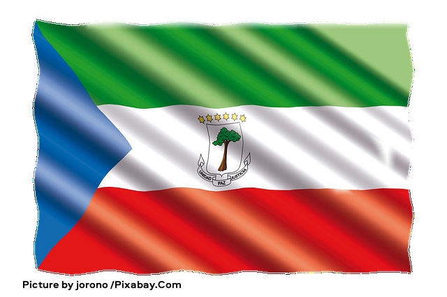
The image above shows the national flag of Equatorial Guinea waving against a white background, with horizontal stripes of green, white, and red and a blue triangle at the hoist. Centered on the white band is the national coat of arms, featuring a silk-cotton tree, six yellow stars, and a ribbon reading “UNIDAD PAZ JUSTICIA,” which translates into English as “Unity, Peace, Justice.” The fabric appears rippled and glossy, with a small credit line beneath the flag. Image by jorono / Pixabay.Com.
Bioko, called Fernando Po until the 1970s, is the largest island in the Gulf of Guinea, covering 2,017 square kilometers (779 square miles). It is about 70 kilometers (43 miles) long and 32 kilometers (20 miles) wide. The island is volcanic and lies on the Cameroon Volcanic Line, the same chain as Mount Cameroon, Príncipe, São Tomé, and Annobón. Three overlapping basaltic shield volcanoes form it: Pico Basilé in the north, the highest point in the country at about 3,011 meters (9,879 feet); Pico Biao in the southeast; and the Gran Caldera de Luba in the southwest. A valley between the northern and southern highlands crosses the island at its narrowest point. Of the three volcanoes, only Pico Basilé has a recorded historic eruption, most recently in 1923. Much of the island is covered in tropical rainforest, with plantations and settlements concentrated at lower elevations. Malabo, on the north coast, is the long-standing seat of government; Ciudad de la Paz, on the mainland, is the designated new capital, and some government functions have moved there. Luba is the other main harbor. The roughly 195-kilometer (121-mile) coastline is steep and rugged in the south and lower and more accessible in the north. The 2015 census recorded 335,048 people on the island.
Río Muni covers 26,003 square kilometers (10,040 square miles). A coastal plain rises inland into valleys separated by low hills and spurs of the Crystal Mountains. The Río Benito, or Mbini, divides the region roughly in half and is navigable only for a short distance near its estuary, about 20 kilometers (12 miles). Temperatures and humidity are generally lower than on Bioko.
Annobón, named for its discovery on New Year’s Day in 1472, is a small volcanic island. Published areas range from about 17 to 21 square kilometers (6.6 to 8.1 square miles); it is roughly 6 kilometers (4 miles) long and 3 kilometers (2 miles) wide. It is the southernmost island of the Cameroon Volcanic Line and is an extinct volcano of basaltic lava and pyroclastic rock. The coast is abrupt except in the north, where the principal settlement, San Antonio de Palé, stands. Rocky islets, including Santarém, lie offshore. The main crater holds Lago A Pot, and the highest peak, Quioveo, rises to 598 meters (1,962 feet). The 2015 census recorded 5,323 inhabitants. The climate is tropical, with heavy rainfall, high humidity, and frequent seasonal windstorms.
Most people live on the mainland, especially in the coastal province of Litoral around Bata, and in Malabo on northern Bioko. Annobón is the least populated province. The national statistical institute, INEGE, estimated the population at 1,727,151 in its 2026 statistical yearbook, with annual growth of 3.4 percent in 2025. Other international estimates for the mid-2020s are higher, about 1.8 to 1.9 million. The population is young, with a median age in the low 20s, and growth is driven mainly by a high birth rate.
The Fang are the largest ethnic group and are concentrated on the mainland; older official estimates put them at roughly four-fifths of the population. The Bubi are the indigenous people of Bioko. Smaller groups include the Ndowe and related coastal peoples of Río Muni, the Bisio, and the Annobonese. Spanish is the principal official language. French and Portuguese also have official status. Fang, Bubi, and other local languages are widely spoken. Annobón has its own Portuguese-based creole, Fa d’Ambô.
The climate of both the mainland and the islands is equatorial: high temperatures, heavy rainfall, and extensive cloud cover for most of the year. Local differences depend mainly on altitude and exposure to monsoon winds. On the mainland, the wetter periods run from about February to June and from September to December, with a drier interval in July and August. Rainfall is generally higher on the coast than inland. Recent station series put Bata at roughly 1,800 to 2,800 millimeters (70 to 110 inches) a year, depending on the record used; older country studies cited more than 2,388 millimeters (94 inches), with September through November the wettest months. Farther south, older reports for Calatrava reached about 4,572 millimeters (180 inches). Inland totals are lower, though some modern averages for Mikomeseng are well above the roughly 1,473 millimeters (58 inches) given in older sources. The average annual temperature on the mainland is about 26 °C (79 °F) and varies little through the year.
On Bioko, a drier season lasts from about November to March, and the rest of the year is rainy. Malabo averages about 25 °C (77 °F), with afternoon highs often in the high 20s °C (low to mid-80s °F) and nights near 21 to 23 °C (70 to 73 °F). Skies are cloudy much of the time. Malabo, sheltered by the northern highlands, receives about 1,870 millimeters (74 inches) a year. The southern coast is far wetter: San Antonio de Ureca is widely cited at about 10,000 to 11,400 millimeters (400 to 450 inches), among the highest reported totals in Africa, though the extreme figures rest on limited records.


