The Democratic Republic of the Congo (DRC) is the largest country in sub-Saharan Africa, covering 2,344,858 square kilometers (905,355 square miles). Straddling the equator, most of its territory lies within the broad Congo River Basin—a vast, low-lying, plateau-shaped depression that slopes gently westward and is blanketed by tropical rainforest and threaded by an extensive network of rivers.
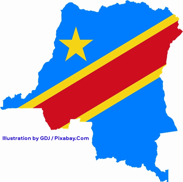
The illustration above depicts the outline map of the Democratic Republic of the Congo filled with the design of its national flag, featuring a bright blue background, a yellow five-pointed star positioned in the upper left portion, and a bold red diagonal stripe bordered by thinner yellow lines stretching across the map from the lower left toward the upper right. Illustration by GDJ / Pixabay.Com.
The forested heart of the basin is ringed by mountainous terraces to the west, plateaus that give way to savannas in the south and southwest, and dense grasslands north of the Congo River. Along the eastern borders with Rwanda and Uganda rise the high peaks of the Ruwenzori Range—some exceeding 5,000 meters (16,000 feet)—which form part of the Albertine Rift montane forests.
Geographers commonly divide the country into three principal regions based on terrain and vegetation: the central Congo Basin, the uplands to its north and south, and the eastern highlands.
The central Congo Basin forms the country’s core. Averaging about 44 meters (144 feet) in elevation, it spans roughly 800,000 square kilometers (310,000 square miles)—approximately one-third of the DRC’s land area. Much of its forest is swampy; the remainder mixes marshes with firmer ground.
North and south of the basin rise higher plains and occasional hills clothed in varying combinations of savanna grasses and woodland. The southern uplands, also about one-third of the national territory, slope northward from roughly 1,000 meters (3,300 feet) near the Angolan border to about 500 meters (1,600 feet) near the basin. Vegetation here is more diverse than in the northern uplands: woodland dominates in some districts, savanna grasses in others. Gallery forests line the streams that feed the Kasai River, while the far southeast—most of the former Katanga Province—features higher plateaus and low mountains. A partly forested western panhandle extends to the Atlantic Ocean, dropping abruptly to a narrow shoreline only about 40 kilometers (25 miles) long.
The much narrower northern uplands form a transitional belt of higher plains and dissected plateaus lying north of the central Congo Basin. Elevations average about 600 meters (2,000 feet) but climb to around 900 meters (3,000 feet) where the region approaches the western edge of the eastern highlands. The landscape consists largely of undulating to gently rolling terrain, with occasional inselbergs and low hills rising above the plateau surface. Unlike the more varied southern uplands, vegetation here is predominantly savanna—tall grasses interspersed with scattered trees and shrubs—while continuous woodlands remain relatively scarce. Gallery forests often fringe the major rivers and streams.
This zone corresponds largely to the Northern Congolian forest-savanna mosaic ecoregion, which marks an abrupt transition between the dense Guineo-Congolian rainforests to the south and the drier Sudanian savannas farther north. Annual rainfall typically ranges from 1,200 to 1,600 millimeters (47 to 63 inches), supporting a tropical savanna climate with a distinct wet season and a dry season. Major waterways such as the Ubangi and Uele rivers drain much of the area and help define its southern and central boundaries with the rainforest zone. The region includes important protected areas such as Garamba National Park, which preserves remnants of northern savanna ecosystems and associated wildlife.
The eastern highlands constitute the highest and most rugged part of the country. Stretching more than 1,500 kilometers (930 miles) from north of Lake Albert to the southern tip, and ranging in width from 80 to 560 kilometers (50 to 348 miles), the region’s hills and mountains rise from about 1,000 meters (3,300 feet) to more than 5,000 meters (16,000 feet). The western arm of the Great Rift Valley marks its natural eastern boundary; the DRC’s frontier runs through the valley and its chain of lakes, which are separated by plains lying between high mountain ranges. Vegetation shifts markedly with altitude, from montane savanna to dense montane forest. The Rwenzori Mountains, lying between Lakes Albert and Edward, form Africa’s highest range; their equatorial location produces an especially varied and spectacular flora.
The Congo River and its tributaries drain this basin and provide the DRC with the most extensive network of navigable waterways in Africa. The Congo–Lualaba–Chambeshi system measures approximately 4,700 kilometers (2,900 miles) in length, making it Africa’s second-longest river after the Nile and one of the world’s longest. Its drainage basin covers roughly 3.7 to 4 million square kilometers (about 1.4 to 1.55 million square miles)—the second-largest on Earth after the Amazon—and encompasses nearly the entire DRC as well as parts of neighboring countries.
The river’s average discharge at the mouth reaches about 41,000–42,000 cubic meters per second (roughly 1.45–1.48 million cubic feet per second), ranking it second globally after the Amazon (or third when the Ganges–Brahmaputra system is considered separately). It is also the world’s deepest recorded river, with measured depths exceeding 220 meters (720 feet) in the lower course. At its midpoint the main channel is about ten kilometers (six miles) wide.
The source is conventionally taken as the Chambeshi River in northeastern Zambia (the longest headstream), though the Lualaba River, rising on the Katanga Plateau in southeastern DRC, contributes the greatest volume. The upper course, known as the Lualaba, flows northward through lakes, swamps, and rapids before becoming the Congo proper below Boyoma Falls (formerly Stanley Falls) near Kisangani. From there the river describes a vast counterclockwise arc: northwest through the rainforest, then west and southwest past Mbandaka, joining major tributaries such as the Ubangi (from the north) and the Kasai (from the south, one of its largest left-bank feeders). It expands into the lakelike Pool Malebo (Stanley Pool) between Kinshasa and Brazzaville before plunging through the Livingstone Falls—a series of some 32 rapids and cataracts spanning roughly 350 kilometers (220 miles)—and reaching the Atlantic Ocean near Banana.
Its flow remains remarkably steady because tributaries arrive from both sides of the equator; the complementary alternation of rainy and dry seasons north and south of the equator guarantees a relatively constant supply to the main channel. Where navigation is blocked by rapids and waterfalls, the sudden descents create an enormous hydroelectric potential—greater than that of any other river system on Earth. The Inga site alone (within the Livingstone Falls complex) already hosts two operational plants (Inga I, about 351 MW, and Inga II, about 1,424 MW); the proposed Grand Inga complex could generate 40,000 MW or more, enough in theory to power a substantial portion of the African continent.
Virtually the entire country belongs to the Congo River system, a fact that has long facilitated trade and external access. The network of waterways is dense and evenly distributed except in three areas: northeastern Mayombe in Kongo Central, drained by the small coastal Shilango River; a strip along the eastern border beside Lakes Edward and Albert that belongs to the Nile Basin; and a small portion of the extreme southeast that lies in the Zambezi Basin and drains toward the Indian Ocean. The river and its tributaries support exceptional aquatic biodiversity, including hundreds of fish species, many endemic, and form a vital artery through the world’s second-largest rainforest.
Most of the DRC’s lakes also form part of the Congo system. In the west, Lac Mai-Ndombe and Lac Tumba are remnants of a once-vast interior lake that occupied the entire basin before the Congo River breached its rim and drained it. In the southeast, Lake Mweru straddles the Zambian border. On the eastern frontier, Lac Kivu—Central Africa’s highest lake and a major tourist destination—and Lake Tanganyika, immediately to its south, both feed the Lualaba River (the name often given to the upper Congo). Only the northernmost great lakes, Edward and Albert, drain northward into the Nile Basin.
Climate varies from tropical rainforest in the Congo Basin to tropical wet-and-dry in the southern uplands and tropical highland conditions above 2,000 meters (6,600 feet) in the east. Temperatures and humidity are generally high. In the equatorial forest, daytime highs typically range from 30–35 °C (86–95 °F) and nighttime lows seldom fall below 20 °C (68 °F); the annual average is about 25 °C (77 °F). In the southern uplands, especially far-southeastern Katanga, winters are cool and dry while summers are warm and humid. The lakes of the eastern highlands enjoy a moist climate with a narrow temperature range; the surrounding mountains are cooler still. Humidity rises with altitude until saturation produces nearly constant mist on some slopes, notably in the Rwenzori.
Because the country straddles the equator, rainfall patterns reverse across it. North of the equator the dry season runs roughly from early November to late March—the rainy season for the southern two-thirds. Many localities experience two wet and two dry seasons. Annual rainfall averages 1,000–2,000 millimeters (39–79 inches), highest in the heart of the basin and the highlands west of Bukavu and declining with distance from these cores. Only parts of the southeast endure prolonged four- to five-month dry seasons and occasional droughts.
Environmental pressures are severe and interconnected. Poaching ranks among the most critical threats to the DRC’s extraordinary biodiversity. Commercial and subsistence hunting for bushmeat—estimated at millions of tons extracted annually across the Congo Basin—has intensified with population growth, urban demand in cities such as Kinshasa, and the presence of mining camps and armed groups. High-value products including ivory, pangolin scales, skins, and live animals for the pet trade fuel organized trafficking networks, often linked to militias and cross-border criminal groups.
Iconic species have suffered catastrophic losses. Forest Elephants (Loxodonta cyclotis) have declined dramatically due to ivory poaching, with populations in many protected areas reduced by more than half in recent decades. The Okapi (Okapia johnstoni), endemic to the DRC’s forests, continues to face pressure from bushmeat hunting and skin trafficking in reserves such as the Okapi Wildlife Reserve. Grauer’s Gorillas (Gorilla beringei graueri), also known as Eastern Lowland Gorillas, now critically endangered, experienced an estimated 77 percent population decline between the mid-1990s and 2016, largely from bushmeat poaching during periods of conflict; Kahuzi-Biega National Park remains their primary stronghold. Northern White Rhinoceroses (Ceratotherium simum cottoni) were driven to functional extinction in the wild in Garamba National Park through sustained poaching. Primates, hoofed mammals, and numerous smaller mammals are routinely targeted, leading to local extinctions and the phenomenon of “empty forests.” The African Wild Dog (Lycaon pictus) has been completely extirpated from the DRC as a result of habitat loss, disease, human conflict, and hunting pressure.
Armed conflict exacerbates the crisis: groups operating in and around Virunga, Garamba, and other parks use poaching to fund operations, while insecurity limits ranger patrols. The loss of large mammals disrupts ecological processes such as seed dispersal and forest structure maintenance, compounding habitat degradation from deforestation (driven chiefly by agricultural expansion and refugee movements), soil erosion, water pollution, and destructive mining of coltan, diamonds, and gold. Despite these challenges, intensified anti-poaching efforts in some parks, community engagement, and international support have produced localized recoveries, underscoring both the urgency and the potential for effective conservation.


