Cameroon is the world’s 53rd largest country, covering a total area of 475,440 km² (183,570 sq mi). Its land area spans 472,710 km² (182,510 sq mi), with 2,730 km² (1,050 sq mi) of water. Slightly larger than Sweden and the U.S. state of California, it is comparable in size to Papua New Guinea.
Located in Central and West Africa, Cameroon borders the Bight of Biafra (part of the Atlantic Ocean) and lies between Equatorial Guinea and Nigeria.
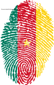
The image above displays a stylized fingerprint in the shape of an oval with concentric swirling ridges, creatively colored in the pattern of the Cameroonian flag featuring a green section on the left, a central red band with a yellow five-pointed star, and a yellow section on the right, all set against a clean white background. Picture by CatsWithGlasses / Pixabay.Com.
Africa in miniature: Landscape and geographic zones
Cameroon is often called “Africa in miniature” because it contains nearly every major climate and ecosystem found on the continent. Its highly diverse landscape includes low-lying coastal plains, dense tropical rainforests, rugged mountains and highlands, rolling plateaus, vast savannas, and semi-arid plains stretching toward the north.
The country can be divided into five main geographic zones, each defined by distinct physical features, climate, and vegetation:
- Coastal lowlands: This narrow, hot, and humid belt extends 20 to 80 km (10 to 50 mi) inland from the Gulf of Guinea. It features mangrove swamps, sandy beaches, and dense equatorial rainforests, especially around the Wouri estuary and Douala. The region is known for high rainfall, fertile soils, and rich biodiversity, though parts are prone to flooding. Mount Cameroon, an active volcano, dramatically rises near the coast in some areas.
- Southern plateau and rainforest: Dense tropical forests dominate the south, gradually transitioning into wooded areas.
- Western highlands: Dramatic mountainous terrain, including Mount Cameroon (4,045 m / 13,271 ft), an active volcano and the highest point in West Africa, along with the scenic Bamenda Highlands.
- Adamawa plateau: A central highland region that acts as a transitional zone between the forested south and the drier north.
- Northern plains: These vast, flatter landscapes stretch from the Adamawa Plateau northward to the Lake Chad basin. Characterized by open savanna grasslands and semi-arid conditions, the terrain includes scattered rock formations and inselbergs, notably the Mandara Mountains. This zone experiences hotter and drier conditions, with vegetation shifting from wooded savanna to thorny steppe in the far north.
This variety of landscapes — from lush green coasts and forests to dry northern plains — creates striking contrasts across relatively short distances.
Rich biodiversity
The country’s diverse landscapes support exceptional biodiversity. Cameroon contains approximately 22 million hectares of the Congo Basin forest ecosystem. These forests are home to around 9,000 plant species, 900 bird species, and 320 mammal species, including 156 endemic plants, 8 endemic birds, and 14 endemic mammals. The border region with Nigeria is recognized as one of the most biodiverse areas in Africa.
To protect its natural heritage, Cameroon has actively pursued conservation since 1932, establishing a network of protected areas that includes national parks, wildlife sanctuaries, faunal reserves, and one flora sanctuary.
Rivers and drainage
Cameroon features four main drainage patterns:
- In the south, several major rivers flow southwest or westward directly into the Gulf of Guinea. These include the Wouri River (which empties near Douala), along with the Dibamba, Bimbia, Mungo, Sanaga, Nyong, and Ntem rivers. North of the coast, the Akwayafe and Manyu (which joins the Nigerian Cross River) also drain into the Atlantic.
- The Dja and Kadeï rivers flow southeastward into the Congo River basin.
- In northern Cameroon, the Benoué (Benue) River flows north and west, eventually joining the Niger River.
- The Logone River flows northward into Lake Chad.
Some of Cameroon’s international borders follow rivers, including the Aïna, Akwayafe, and Ntem (also known as the Campo) rivers.